Educational and Reference Resources of the Tri-Canyons
Ecology on the Trail: Ecology
Observation Point Trail, Snowbird, UT
Welcome to Trails Online! Each week we will provide information and activities pertaining to a specific trail in the Cottonwood Canyons, though you can also use this material from the comfort of your own home or school. Whether you’re on the trail or in your home, we hope you enjoy learning more about our Canyons!
This week we are focusing on the foundations and using this as a springboard for subsequent weeks. This guide is best used by teachers or parents to facilitate learning for their students or children. Pre-activities and post-activities are recommended to be done at home or at school, before heading into the canyons.
If you are a teacher using this material in your virtual classroom, we are also including a teacher presentation and a student guide. The questions posed in the material are great discussion-based questions designed to promote critical thinking about the canyon environment, and additionally the student guide can be used to have students write out their answers as they go.
← Look for this Earth Icon to easily locate activities or bonus tips.
Teacher Supplements
Teacher Presentation
Student Guide
Be Prepared and Leave No Trace
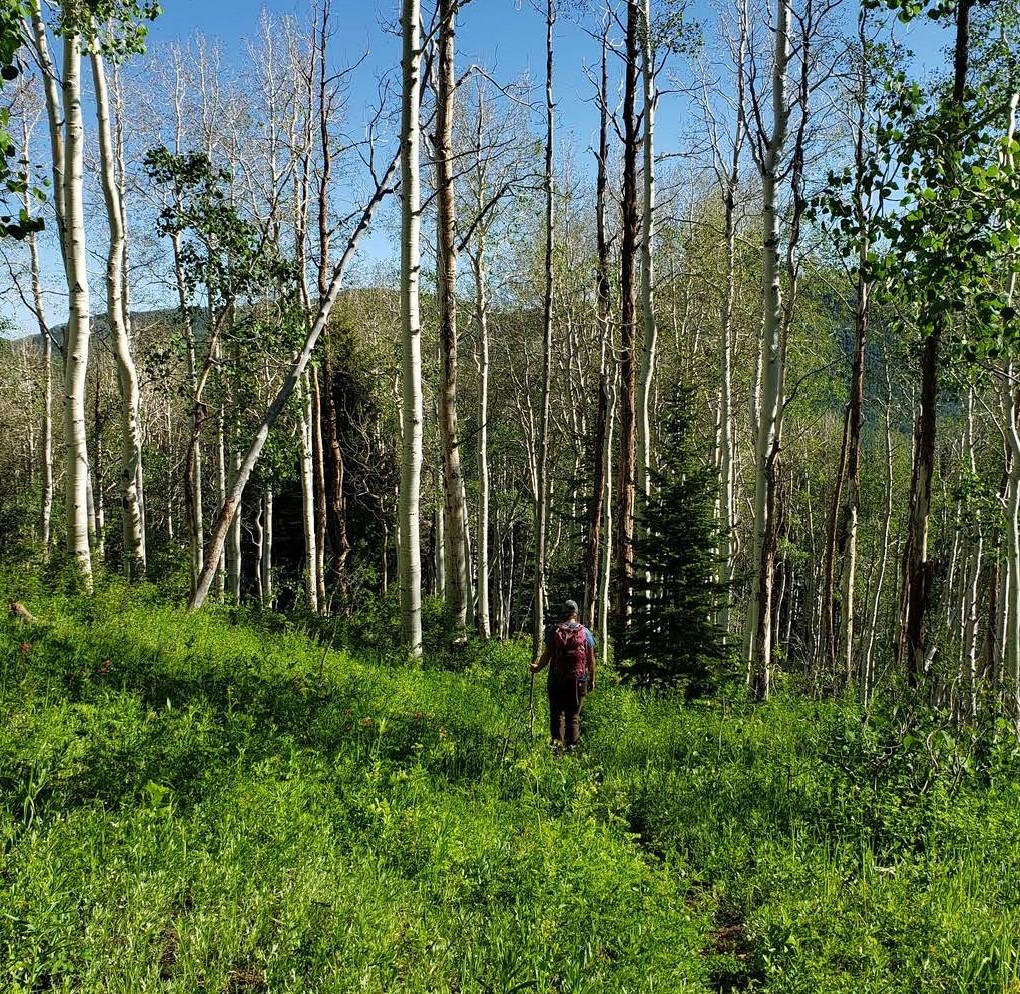
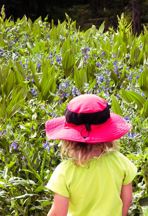 If you are headed out into the canyons, please make sure you are prepared! Proper footwear, sunscreen, water, and snacks are all helpful things to have with you. Taking a notebook to draw pictures or write down your observations is also encouraged! Please remember to stay on designated trails and leave what you find.
If you want to know more about how to be a responsible recreator, please check out the 7 Leave No Trace Principles:
- Plan ahead and prepare – Consider what you might need for this outing. Make a check list to ensure you’re prepared to head out the door!
- Travel and camp on durable surfaces – Stay on designated trails and only camp in established areas.
- Dispose of waste Properly – Pack out all waste or trash. Additionally, this location does have a restroom available inside the Snowbird Center. Please utilize these before starting your trail to help keep our watershed clean!
- Leave what you find – As pretty as the flowers, trees and rocks are, we need to leave then where we find them . If something inspires you, take a picture or take a second to sketch it.
- Minimize campfire impact – Similar to camping on durable surfaces, if you are camping in the area, camp in a location where there is an established fire ring. Check on fire danger level before starting a fire. And if you have one, make sure the fire is out and coals are cool.
- Respect wildlife – Give wildlife some space. Use the rule of thumb! If you can close one eye, and with an outstretched arm you can cover the animal with your thumb, you’re at a safe distance. If you can still see the animal, then you should give it some more space.
- Be considerate of other visitors – People go into nature for many reasons. Some go to listen, others go for exercise, or many other reasons! Be courteous of others on the trails so everyone can enjoy the outdoors.
More information about Leave Not Trace can be found at Leave No Trace Principles.
Week One Map – Observation Point Trail
Observation Point Trail Map
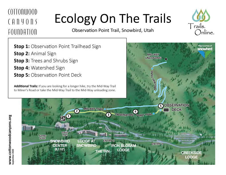
Week One’s Trail is the Observation Point Trail (formerly called the Barrier Free Trail) at Snowbird Ski Resort in Little Cottonwood Canyon.
Directions: Head up Little Cottonwood Canyon to Entry 2 of Snowbird Ski Resort. Park near the Snowbird Center. The trail can be accessed from behind the Snowbird Center building. From the Tram Deck, head over the bridge facing the ski slope and look for the brown Observation Point trailhead sign.
Trail Information: This ADA accessible trail is 0.5 miles one way or 1 mile round trip. It is paved the entire way and has an elevation gain of 100 feet.
Additional Trails: If you are looking for a longer hike, try the Mid-Way Trail to Miner’s Road or take the Mid-Way Trail to the Mid-Way unloading zone. Another great option is to take the Tram up to Hidden Peak. From there, you can enjoy the views of Mineral Basin by taking Sunday Saddle Road to the Wildflower Trail and then back up Miner’s Basin Road. Additional fees to ride the Tram apply.
Please check hours, fees, and COVID health and safety measures at Snowbird Activities.
Pre-Activity – Ecosystems
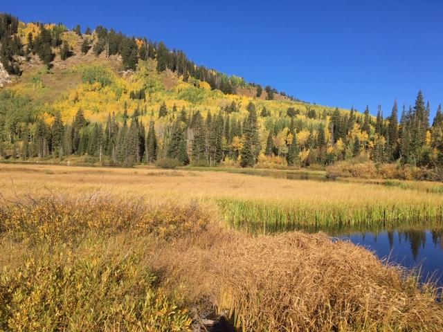 Have you ever heard the word ecosystem? What do you think it means? What does an ecosystem look like? If it helps, try breaking the word down into parts: “eco” and “system”.
An ecosystem is a community of living and nonliving things that interact with one another. Find an outdoor place – your yard, your schoolyard, or a neighborhood park – and take a few minutes to observe the ecosystem around you. What are some of the living things you notice? What are some of the nonliving things you can see, hear, smell, or feel? If you have a notebook, it might be helpful to write or draw pictures of the living and nonliving things around you.
It might be more difficult to think of the nonliving things, but they are just as important to the ecosystem as the living things! Nonliving factors can include the sun, wind, water, and rocks. How are each of these important to living things? One example is that plants need the sun to make food, another example is that rocks can be used by animals for shelter. When you go for your hike, keep thinking about this idea of an ecosystem.
Stop One – Observation Point Trail Sign
Topic: Geology
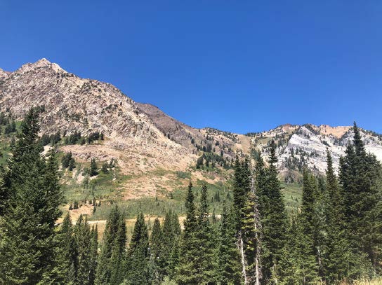 Geology is the study of the Earth, what it is made of, and how it changes over time. A scientist who studies geology is called a geologist. Look across the canyon and make some observations. What do you notice? Are there different colors? The white and black rock is called limestone, and the brown rock you see is either tillite or quartzite. Rocks are made up of different minerals. Just like how you would use different ingredients to make a chocolate cake and a carrot cake, different types of rock have different mineral “ingredients”.
Today we are in the Wasatch Mountains, but can you imagine what this area would have looked like before there were mountains here? How long do you think it took for these mountains to form? They didn’t form overnight – it actually took about 20 million years to form the mountains we are standing in, and certain processes are still impacting this mountain range today. Though we cannot see Earth’s tectonic plates, we can see and sometimes feel the results of their movement. Have you ever experienced an earthquake? The movement you feel is caused by tectonic plates rubbing together. A tectonic plate is a huge slab of rock under the Earth’s surface. The Wasatch mountains were formed as one plate slid underneath another, causing the land to uplift. Do you think the mountains impact the plants and animals that are able to live here?
Stop Two – Wildlife Sign
Topic: Wildlife
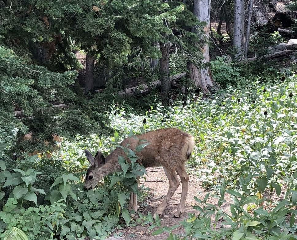 Recall our definition of an ecosystem – a community of living and nonliving things that interact. Wildlife is one of the most easily recognizable living (biotic) parts of an ecosystem. As a living part of the ecosystem they can help shape and change it through their presence. Look around, what wildlife do you see (bees, butterflies, birds, squirrels, deer, moose)? What role do you think they play in this ecosystem? How might they be shaping the environment you are in? For example, consider how plants may need wildlife. Flowers need the bees for pollination, while later in the plant’s life after the flower has turned to seed they may need birds or the fur of a deer to help spread the seeds.
Ecosystems can also determine what kind of wildlife lives there. While Wildlife can surely shape how the ecosystem functions, certain animals have specific requirements to survive. With the next animals you see ask yourself these questions: What does it eat? How does it survive in this environment? As you walk down the trail you may notice some of the coneflowers seem to be missing their stems! During the summer and fall, before the snow becomes too deep, the deer love to snack on these flowers as they are full of nutrients. These flowers grow between the elevation of 7,000-10,400 ft, which also happens to be the perfect location for the deer during these seasons.
Bonus: Look at the animals pictured on the sign. While you are hiking, keep an eye out for any animals or evidence of animals. Evidence of animals may include tracks, feathers, fur, scat, or remnants of a meal! And if you are lucky enough to see an animal, practice the rule of thumb Leave No Trace principle. If you can’t cover it with your outstretched thumb you’re too close!
Stop Three – Trees and Shrubs Sign
Topic: Plants
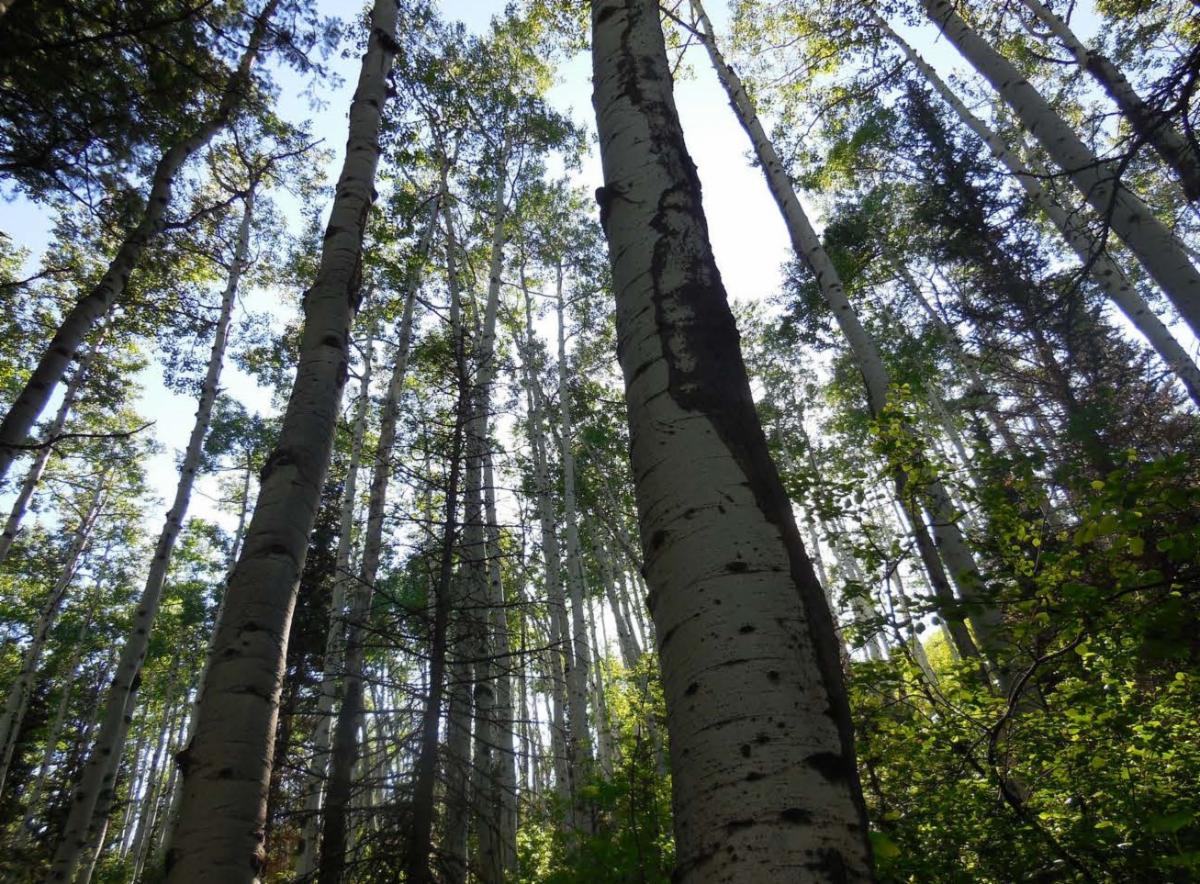 First, let’s think about the trees. What do all trees have in common? They have trunks, branches, and leaves. Trees can be either deciduous or coniferous. A deciduous tree is a tree that loses its leaves in the fall, while a coniferous tree has needle-like leaves that do not fall off. Look at the trees nearby, which do you think are deciduous? Which do you think are coniferous?
Answer: the aspen are deciduous and the spruces and firs are coniferous.
The other plants you see along the trail are called herbaceous plants. Herbaceous plants have a soft stem, not a woody stem or trunk like a tree. Wildflowers and grasses are both examples of herbaceous plants. How might a herbaceous plant have a different role in the ecosystem than a tree?
Bonus: Look at the trees and shrubs pictured on the sign. Which trees can you identify around this stop? If you brought a notebook with you, draw and label the trees you have identified!
Stop Four – Watershed Sign
Topic: Watershed
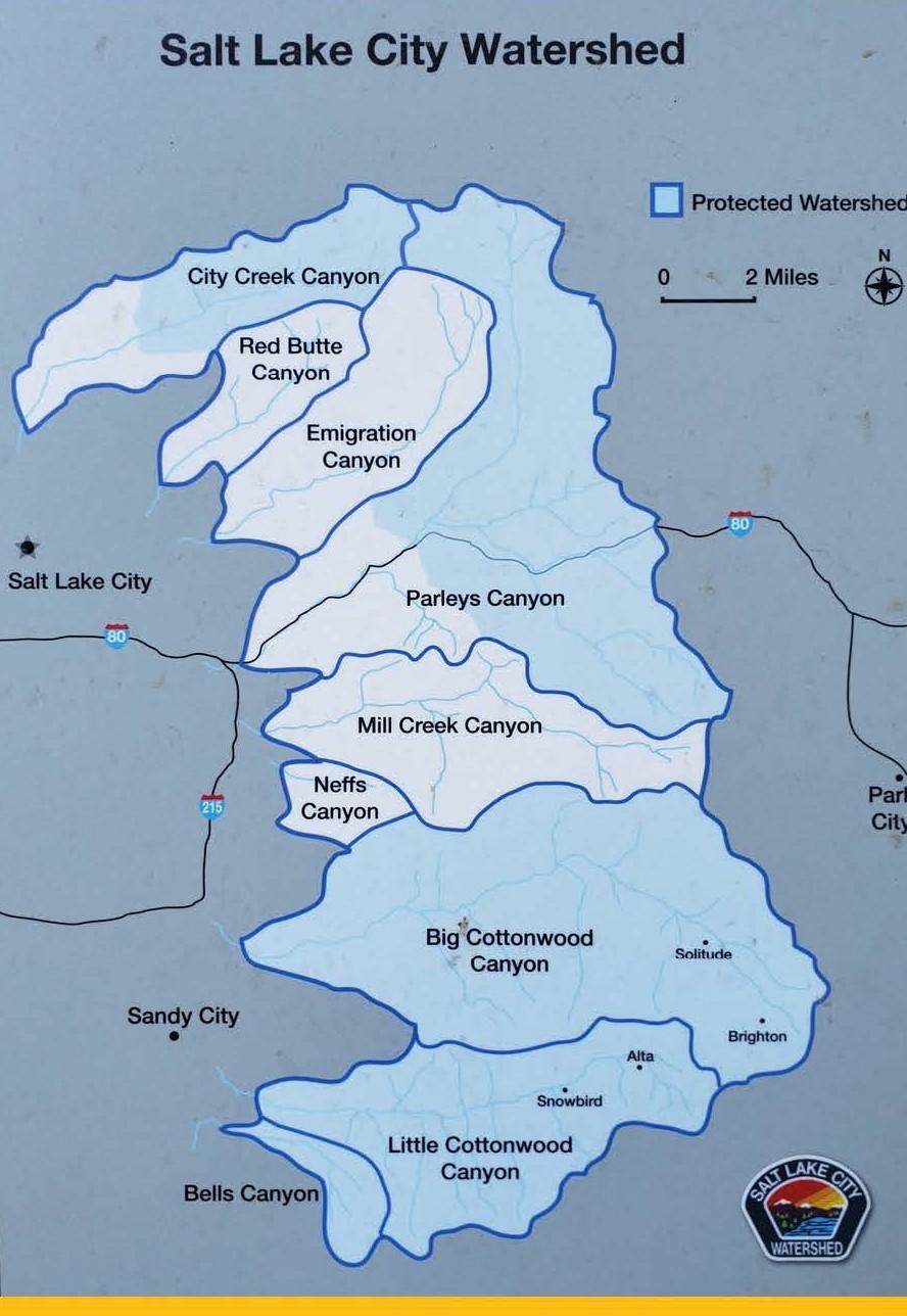 A watershed is a geographic area where all of the water drains to a common point. A watershed also collects, stores, and releases water. Imagine you are a raindrop that lands on the highest peak you can see. After landing, where would you go? You might soak into the ground, or you might trickle downhill. Where might you go after that?
Using the Salt Lake City Watershed map on the Watershed sign (or pictured below), find Snowbird. Which canyon are you in? Is this canyon considered a protected watershed? The answer is yes! We have special rules in place to help keep our watershed clean and safe, which is why you can’t swim in the water or bring your pets into the canyon.
Bonus: The geology of the canyons helps shape the watershed, but can the watershed help to shape the canyon’s geology? Why or why not? Think about this question, as we will come back to this in the coming weeks. How do you think the watershed helps the plants and animals (and even the people) that live in and use the canyons? Is the watershed an important part of the canyon ecosystem?
Stop Five – Observation Point Deck
Topic: History and Human Use
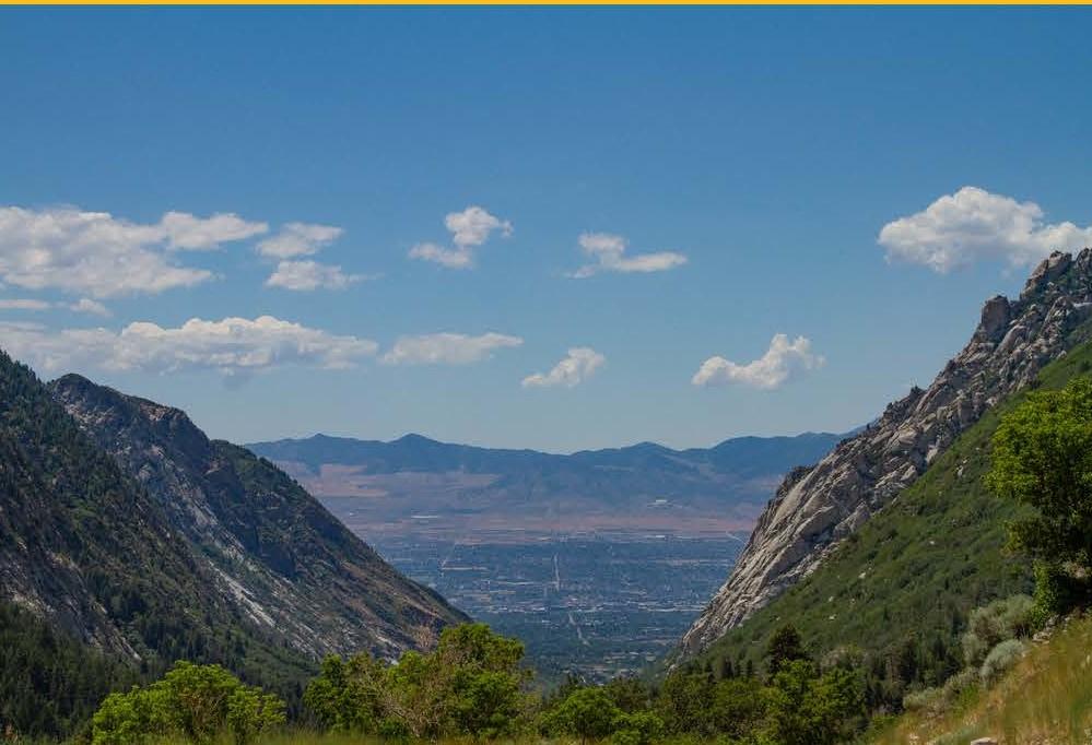 Humans have been living in these canyons and using the abundant natural resources here for a long time! This land was first used by the Fremont, Shoshone, and Ute tribes. The forest was even named after the Ute word “Wasatch” which means “low place in high mountains”. Pioneers came into the area in the 1800s and used the canyons for timber, livestock grazing, mining, and water. Today, the canyons are popular for recreational activities like hiking, fishing, camping, and skiing.
Humans can have significant impacts upon an ecosystem, sometimes these impacts can be good and sometimes they can be bad. Have you left an impact on the ecosystems you have seen today? Think about all of the ways that people are using the canyons today, and brainstorm ways that we can help protect them. For example, many people like to picnic in the canyons and one way we can help is by making sure we pack out all of our trash.
Bonus Activity
Bonus Activity: On your walk back, find a quiet spot along the trail that feels inspiring to you. If you’re at home, this can be done in your yard or a neighborhood park. Sit or stand still, close your eyes, and put your hand up in the air. Every time you hear a different nature sound, put a finger down. Do this until you have put all of your fingers down and you have a handful of nature sounds to take home with you.
Post Activity
Now that you’ve observed the ecosystem of your yard, schoolyard, or neighborhood park and the ecosystem around the Observation Point Trail, let’s compare them both. How are they different? How are they the same? Do you see the same living things in both places? What about the nonliving things? Draw a picture or write out your observations.